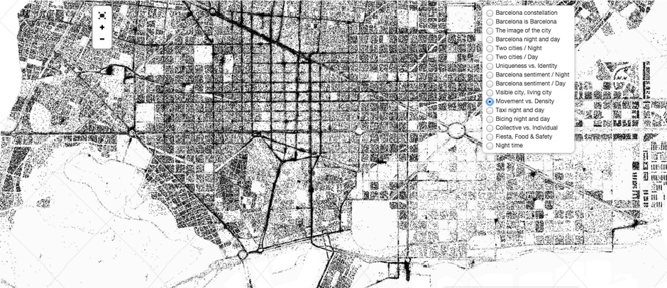
At night in Barcelona, Gaudi’s Parc Guell lights up, and the little restaurants in Las Ramblas hop with energy. People move around, catch cabs, tweet thoughts, take pictures, laugh with friends. Aside from the laughter, these other evening activities can leave a data trace that researcher Mar Santamaria Varas, architect Pablo Martínez Díez, and engineer Jordi Bari Corberó have used to create 16 beautiful maps of the city. The trio’s at Night project offers a fresh presentation of social media activity and open data collected across Barcelona after dark. They hope the project leads to insights about when, where, and how city folks interact with their environment—and perhaps even helps urban planners design the city more intuitively. But the images can be enjoyed in their own right, too. Let’s take a look …READ MORE