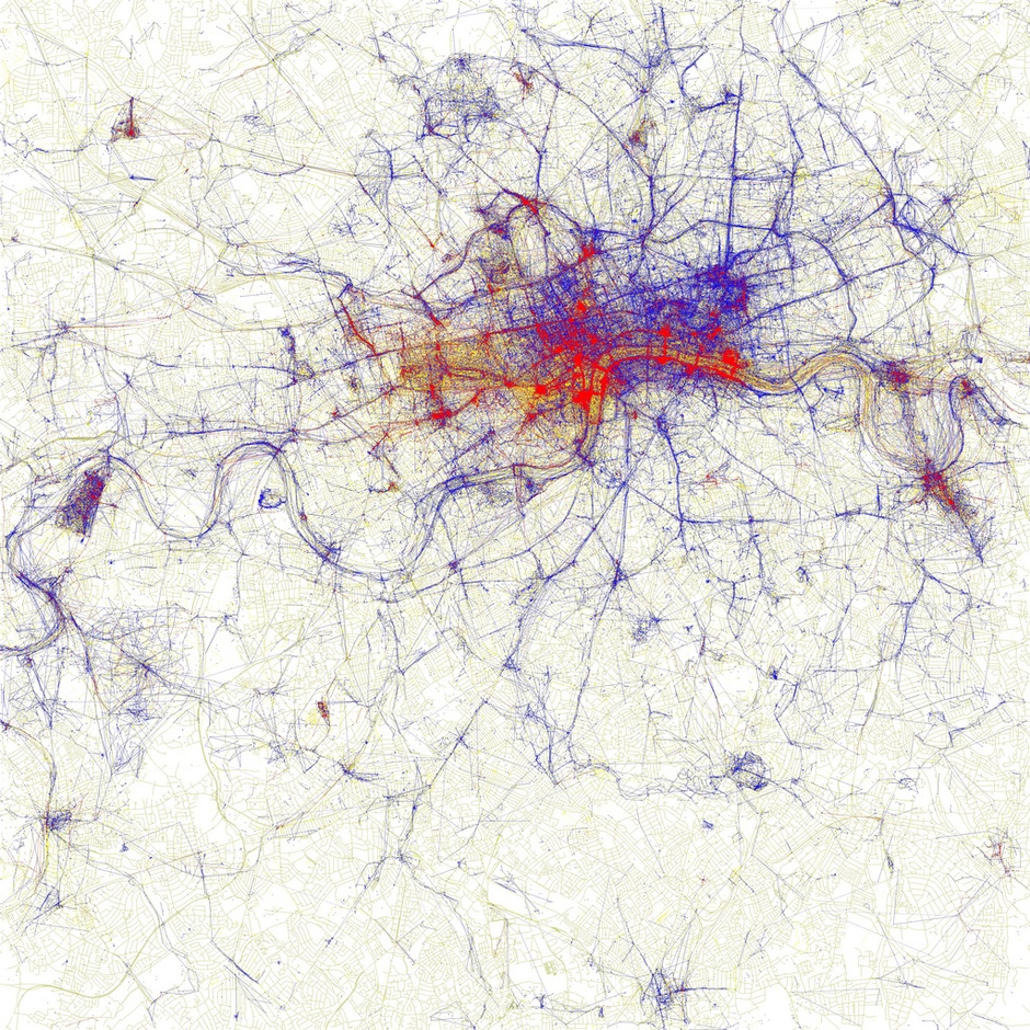
Data artist Eric Fischer creates gorgeous maps of human movement across cities by plotting the social media trails of the world’s denizens. Among other projects for Mapbox, where he currently works, Fischer recently released «Locals & Tourists,» a searchable world map that visualizes the tweets of city residents versus out-of-owners. Using Gnip’s archive of geo-tagged tweets from September 2011 through May 2013, Fischer designated «locals» as those who’d been tweeting from the same city region for one month or longer. Their tweets are blue spots on the map. «Tourists» (red spots) were those who’d been tweeting in that city for less than a month, and who seem to be «locals» in another city. …READ MORE